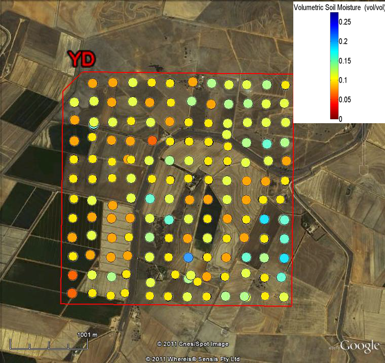
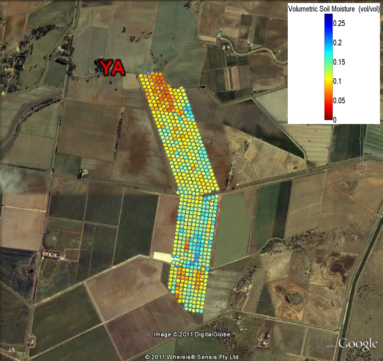
Soil Moisture Sampling
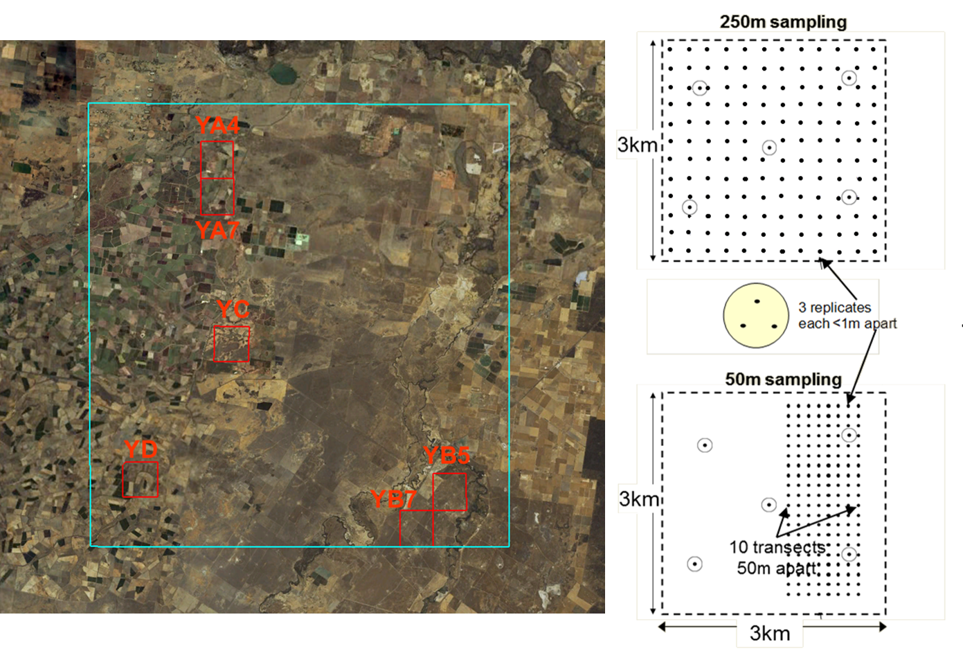
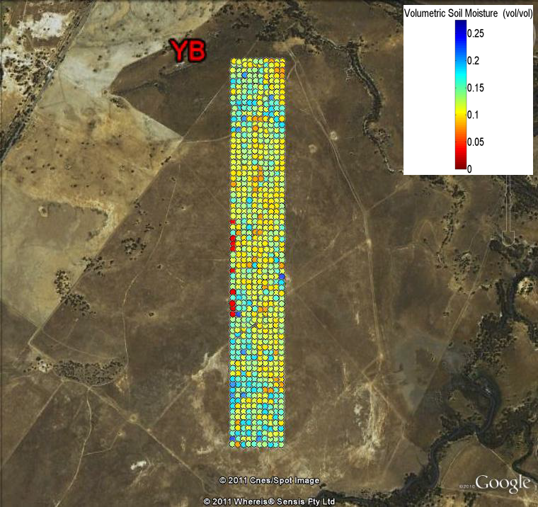
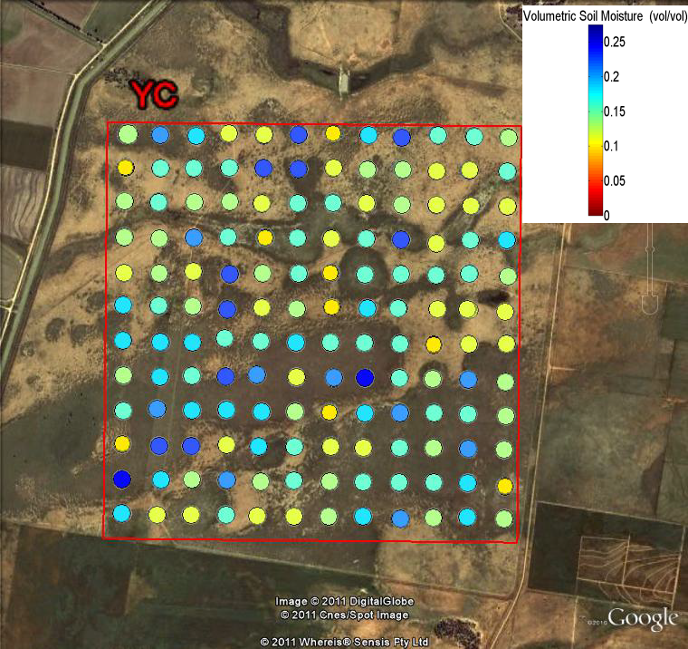
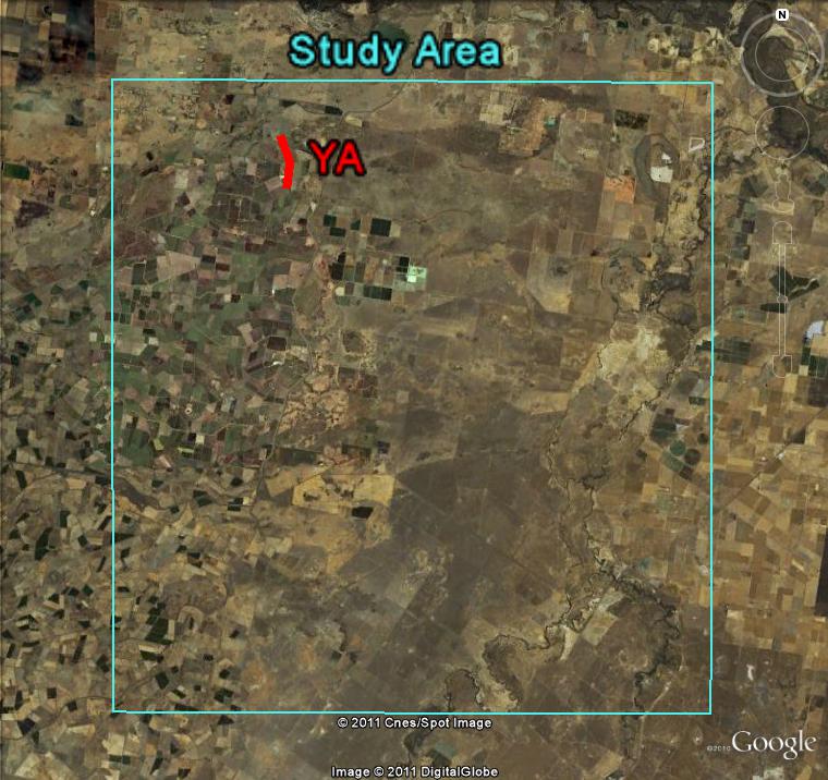
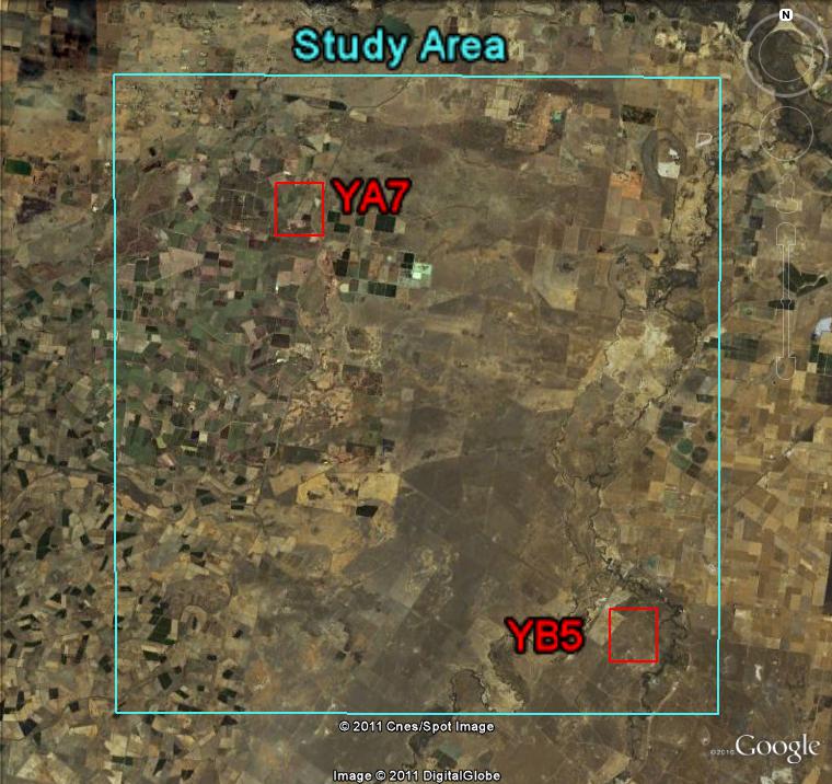
Spatial ground sampling of soil moisture was undertaken concurrently with each flight during SMAPEx-1 (except the transect flight on July 5). During regional flights, sampling was undertaken on a regular grid of 250m-spaced locations in two 3km x 3km focus areas. During target flights ground sampling of soil moisture was undertaken every 50m along ten 3km long transects. On each transect measurements were taken at 50 m-spaced locations. At each location three surface soil moisture measurements were taken. This allows the effect of random errors in local scale soil moisture measurements to be minimised. Complete details on the soil moisture sampling strategy and protocols can be found in the SMAPEx-1 workplan and workplan addendum.
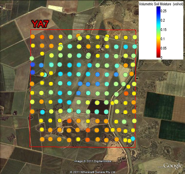
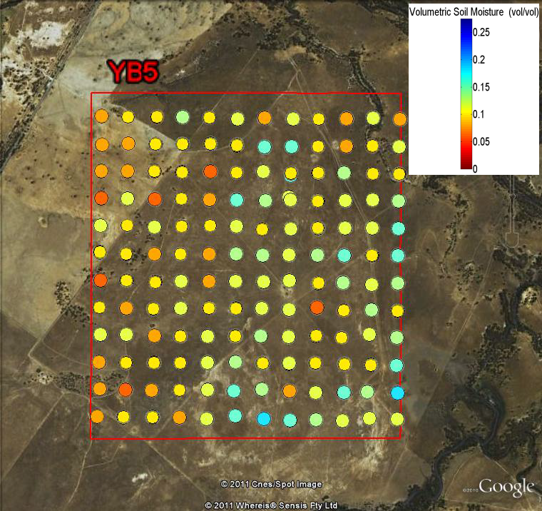
Soil Moisture Sampling Overview
HDAS soil moisture measurements
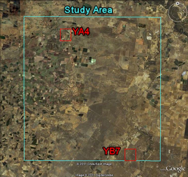
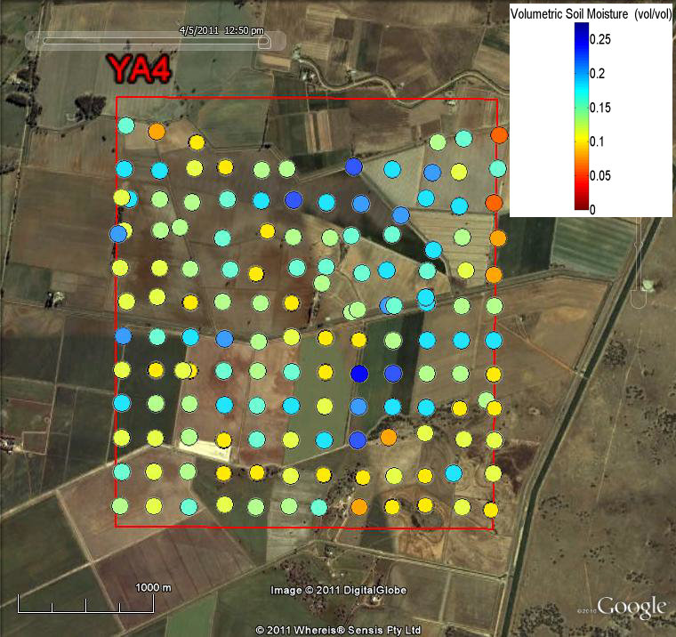
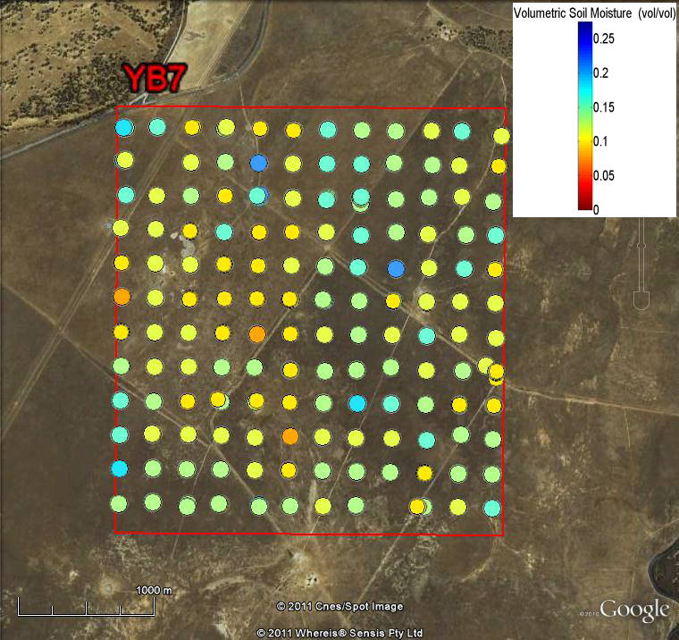
The soil moisture data collected at each focus area are shown in the overview below. Users can download the data of the corresponding patch via the Download Centre .
Hydraprobe Data Acquisition System
Soil moisture measurements during SMAPEx were undertaken using the Hydraprobe Data Acquisition System (HDAS), a powerful spatial data acquisition tool developed by the investigators which integrates a handheld Pocket PC, a Stevens Water Hydraprobe and a GPS receiver into a mobile GIS environment. This system allows navigating to predefined sampling locations and collecting and storing in real-time a variety of spatial data, including the soil moisture, soil temperature and soil salinity provided by the probe as well as a variety of user-prompted observations (land cover type, vegetation canopy height, visual observation of dew presence, visual estimate of surface rock cover fraction, irrigation type).
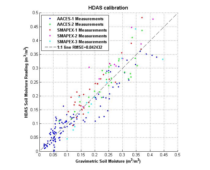
Hydraprobe Calibration
The soil moisture calibration equation for the HDAS was derived from the analysis of a large number of laboratory and field gravimetric samples collected in previous campaigns by Merlin et al (2007). The quality of the calibration was confirmed by analysis of gravimetric data from the SMAPEx and related AACES experiments.